Location
25 km north of Monto
About 500 km north-west of Brisbane
Walks
8 graded tracks
From 300 m to 22 km return
Entry
Day use only
No camping in the park — stay nearby
Phone coverage in the gorge is unreliable — print it, or choose "Save as PDF" in the print window.
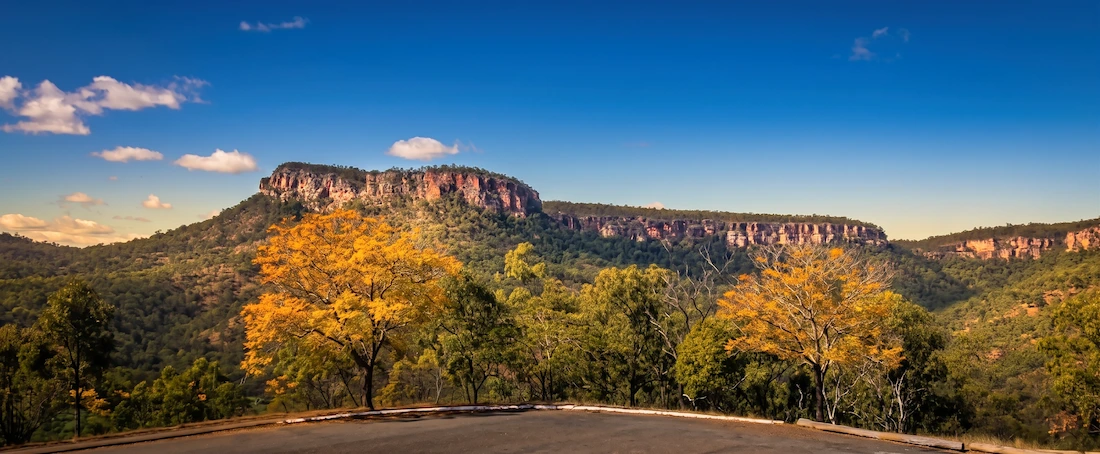
Cania Gorge is a sandstone gorge in the North Burnett, with cliffs up to 70 metres high, caves, quiet fern pools and dry rainforest along Three Moon Creek. It protects part of the Brigalow Belt, First Nations art sites and the remains of the Cania Goldfields. Most visitors base themselves at Monto or at the private parks inside the gorge.
Cania Gorge walking tracks
Eight graded tracks, listed shortest first. Allow 15–20 minutes per kilometre, and more with young children. Carry drinking water on every walk.
- Grade 2 · Easy
Picnic Area circuit
300 m return About 20 min
Starts: Either end of Three Moon picnic area
An easy stroll beside Three Moon Creek with views of the sandstone cliffs and eucalypt woodland.
- Grade 3 · Moderate
Big Foot Walk
1 km return About 20 min
Starts: Car park 900 m south of Three Moon picnic area
Runs beside the road to a large brown image of a four-toed foot on the white sandstone cliff.
- Grade 3 · Moderate
Two Storey Cave circuit
1.3 km return About 45 min
Starts: Opposite Three Moon picnic area
Winds up around sandstone monoliths, with a 20 m side track to King Orchid Crevice. The upper cave is bat habitat — please don't disturb them.
- Grade 3 · Moderate
Shamrock mine site
1.4 km return About 45 min
Starts: Northern car park, about 1 km south of Lake Cania
A self-guided walk past mine shafts, mullock heaps and the old battery of the Cania Goldfields. Gold fossicking is not permitted.
- Grade 3 · Moderate
Dragon Cave and Bloodwood Cave
2.6 km return About 1 hr
Starts: Three Moon picnic area, via the Dripping Rock track
A moderately steep climb to the cliff face. Dragon Cave shows a natural black 'dragon' on white sandstone; Bloodwood Cave is named for the tree roots at its edge. Includes creek crossings.
- Grade 3 · Moderate
Dripping Rock and The Overhang
3.2 km return About 2 hr 30 min
Starts: Southern end of Three Moon picnic area
Crosses Three Moon Creek through woodland and dry rainforest to Dripping Rock (2.2 km return), then on to The Overhang's yellow and red weathered cliff.
- Grade 3 · Moderate
Fern Tree Pool and Giant's Chair circuit
5.6 km return About 3 hr
Starts: Car park 900 m south of Three Moon picnic area
Best walked anti-clockwise: past Fern Tree Pool, then a steady climb up the escarpment to Giant's Chair lookout, returning down steep steps. Includes creek crossings.
Unfenced cliff-top lookout — stay on the track and supervise children closely.
- Grade 4 · Hard
Castle Mountain
22 km return Allow 7–8 hr
Starts: Three Moon picnic area, via the Bloodwood Cave track
A steep side track to Gorge lookout, then a 10 km fire trail through open woodland to Castle Mountain lookout. Return the same way.
For experienced bushwalkers only: possible overgrowth, fallen trees, unfenced cliffs and no reliable phone service. Start early and leave a trip plan with someone.
Track details from Queensland Parks and Wildlife Service. Check current track information and closures or download the park map (PDF) before you go.
Hover a thumbnail to enlarge. Photography © Geoff Cramb.
Visitor information
Facilities
- Sheltered picnic tables, barbecues and toilets at Three Moon picnic area
- Wheelchair-accessible toilets and picnic tables (some grassy areas to cross)
- Tank water only — boil or treat before drinking; creek water is unsuitable
- No bins — take your rubbish home
- No camping and no campfires inside the national park
- Mobile phone coverage is not reliable
Wildlife and when to go
Walk in the early morning or late afternoon to see more wildlife and avoid the heat. Look for Herbert's rock-wallabies on the cliffs, whiptail wallabies, lace monitors, king parrots and regent bowerbirds. Platypus live in the waterholes below the dam wall, and red kurrajong flowers in spring. Summer days can be very hot.
Safety
Keep well back from unfenced cliff edges and supervise children. Wear sturdy shoes, a hat and sunscreen, and finish walks in daylight. In an emergency call 000 — phone coverage in the gorge is not reliable. The nearest hospital is in Monto. Official safety advice
Getting to Cania Gorge
Take Cania Road, which leaves the Burnett Highway about 12 km north of Monto (or about 82 km south of Biloela). Drive through Moonford for around 13 km to Three Moon picnic area.
- From Brisbane: about 500 km
- From Bundaberg: about 225 km, via Gin Gin and Mount Perry
- From Gladstone: via the Dawson Highway to Biloela, then south
Navigate to: Three Moon picnic area, Cania Road, Cania Gorge National Park QLD (via Burnett Highway, 12 km north of Monto). Emergency: 000.
Where to stay
Camping is not allowed inside the national park. Privately run caravan and camping parks operate in the gorge, including Cania Gorge Caravan Park and Cania Gorge Tourist Retreat (phone (07) 4167 8188). Monto has hotel, motel and caravan accommodation. National park camping is available at Kroombit Tops, Bulburin and Kalpowar State Forest.
Find accommodation and businesses in MontoNearby towns and places
25 km south
Monto
The gateway town for Cania Gorge, with hotel, motel and caravan accommodation, fuel, supplies and the nearest hospital.
Read the Monto town guide11 km north of Three Moon picnic area
Lake Cania
A council-run recreation and picnic area on the lake shore, popular for fishing, boating, canoeing and swimming.
On Cania Road, on the way in
Moonford
The small locality you pass through on Cania Road between the Burnett Highway and the park.
95 km north-west
Biloela
The nearest larger centre to the north, via the Burnett Highway.
Making a longer trip? See the Burnett Museum Trail, more national parks and camping, or plan your Burnett trip.
History of Cania Gorge
At least 19,000 years
First Nations people have lived in Cania Gorge since at least the height of the last Ice Age. Nine recorded art sites hold freehand paintings of hands, animals and tracks. They are fragile and not open to the public.
1850s
Cania Station was established, running sheep until 1883, when beef and dairy cattle were introduced.
1870 – early 1920s
Gold was found just north of the gorge, and the 'Cania Goldfields' township grew along Three Moon Creek until mining ended in the early 1920s.
1924
Monto opened as a town, and the area east of the picnic ground became a scenic reserve.
1977
Cania Gorge was gazetted as a national park, with additions in 1979 and in 1989, when the Francis family of Cania Station donated the central section.
Early 1980s
Cania Dam was built on Three Moon Creek, and Lake Cania covered the remains of the old goldfields.
The gorge itself formed over millions of years as water wore through Precipice Sandstone along a fault line. Please respect First Nations sites — see our Heritage Portal for more regional history.
Plan my Cania Gorge visit
Tell us how long you have and how much walking suits you, and we'll suggest a day-by-day plan using the tracks and places in this guide.